
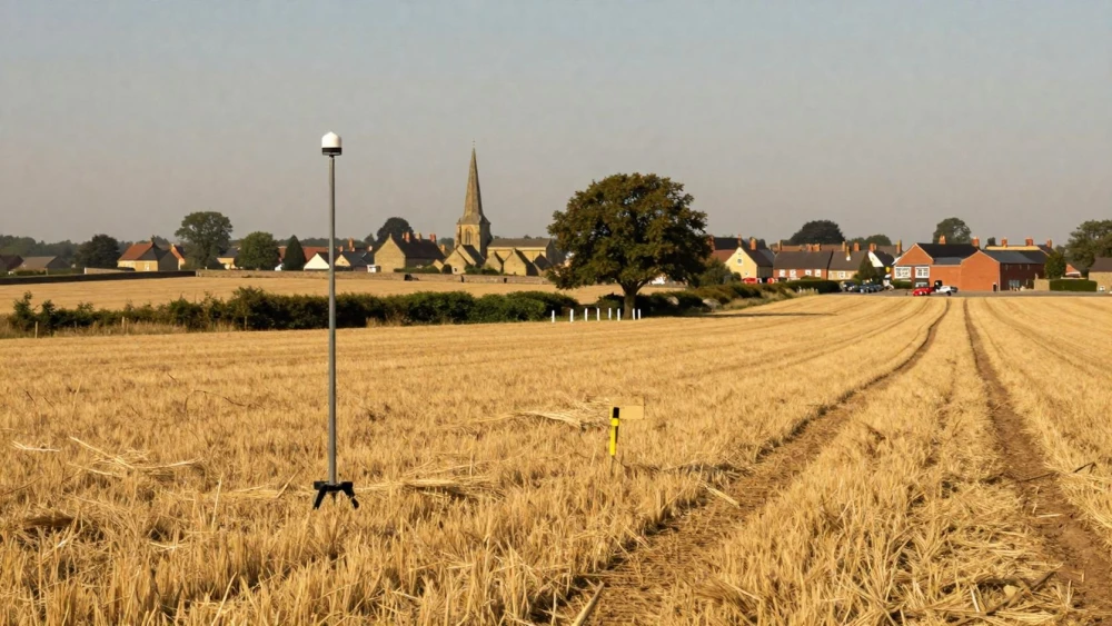
GPS Surveys
Get in TouchAt Northampton Surveys, we specialise in GPS surveys to provide precise and reliable land measurement and mapping services . Our GPS survey services help in accurately determining the geographical location and topographical features of a site for construction, planning and environmental projects.
Using advanced GPS technology, we cater to various sectors, including construction, transportation and urban planning. Contact us today to arrange a professional GPS survey for your project.
How Much Do GPS Surveys Cost?
GPS surveys at Northampton Surveys typically cost between £500 and £1,500, depending on factors such as the size and complexity of the site. Factors affecting the cost include terrain difficulty, survey detail level and required deliverables.
For instance, a congested urban environment may require more precise measurements and use of equipment like RTK GNSS receivers, which enhance accuracy by correcting signal errors. Compliance with standards such as ISO 9001 also necessitates thorough quality checks, influencing project time and cost.
We provide detailed quotes tailored to each project’s requirements. Our experienced team can assist clients from commercial property developers to architects.
For an accurate estimate, contact us today for a free quotation.
What Are the Benefits of GPS Surveys?
GPS surveys offer numerous benefits for projects. They use satellite technology to ensure precision and efficiency across multiple applications:
Accuracy: Achieve centimetre-level accuracy in data collection, a necessity for tasks such as boundary identification and volume calculations. This precision is crucial in complex projects like road construction and urban development.
Efficiency: Quick data processing and delivery of results streamline project timelines. This efficiency is particularly beneficial when surveying large sites or handling urgent deadlines, as it allows for rapid adjustments and decision-making.
Cost-Effective: Reduce time spent on-site, cutting costs associated with traditional surveying methods. This is advantageous for long-term projects where budget constraints are a concern.
Versatility: Suitable for various environments and projects, including topographic surveys and utility mapping. GPS surveys perform well in challenging terrains and adverse weather conditions, extending their applicability across diverse sectors.
If you need reliable data for decision-making, get in touch to discuss your GPS survey needs.
What Does a GPS Survey Cover?
Our GPS surveys cover a wide array of geographic and topographic elements essential for diverse applications, using sophisticated satellite positioning technology. They accurately map:
Boundaries: Exact location of property lines and borders using precise coordinates to comply with legal requirements and land registry standards.
Topography: Contours, elevations and terrain features, providing detailed height data crucial for construction and development planning, enabling efficient landscape design.
Infrastructure: Roads, utilities and existing structures are mapped to within centimetres using Real-Time Kinematic (RTK) GPS, aiding in infrastructure maintenance and urban planning.
Environmental Features: Bodies of water, vegetation and wildlife habitats are documented, assisting environmental assessments and conservation efforts.
These comprehensive surveys ensure all relevant data is captured, supporting tailored planning and decision-making for your specific needs. Reach out to us for further information or to discuss your project requirements.
How Do GPS Surveys Work?
GPS surveys at Northampton Surveys follow a systematic process designed to deliver precise results tailored to property developers, architects, and engineers:
Planning: We begin by assessing site needs, defining survey objectives, and selecting appropriate GPS technology. Factors such as terrain, vegetation cover, and urban infrastructure are considered to determine the best approach and equipment, including dual-frequency GNSS receivers.
Data Collection: Our team uses GPS and GNSS equipment with RTK positioning techniques to collect high-precision onsite data. This involves setting up base stations and roving units to gather geospatial information with centimetre-level accuracy.
Data Processing: Collected data is imported into specialised software, such as AutoCAD and ArcGIS, for analysis, allowing us to create detailed digital terrain models and contour maps. We ensure the data is checked against national mapping standards for consistency and correctness.
Deliverables: We provide clients with comprehensive reports, CAD drawings, and orthophotos, facilitating informed decision-making for site development or construction projects.
Each step is meticulously executed to ensure data accuracy and project success. Contact us today to schedule your GPS survey.
Why Choose Northampton Surveys for GPS Surveys?
Choosing Northampton Surveys means opting for experienced service in GPS surveys. Our expert team employs cutting-edge technology such as GNSS (Global Navigation Satellite System) receivers and total stations that deliver highly accurate geospatial data.
We adhere to the RICS (Royal Institution of Chartered Surveyors) standards, ensuring precision and consistency across all our surveys. Our methodologies, including static, rapid-static, and real-time kinematic (RTK) measurements, are tailored to the unique requirements of commercial, residential, and infrastructure projects.
We focus on accuracy, timely delivery, and client satisfaction, typically completing surveys within two to three days, depending on the project's complexity.
Contact us to benefit from our expertise.
Frequently Asked Questions
How long does a GPS survey take?
A typical GPS survey can be completed in one to three days, depending on site size and complexity. Larger or more complex surveys may take additional time.
How long does a GPS survey last?
The data from a GPS survey remains relevant indefinitely, though we recommend updates if site conditions change significantly or new development occurs.
What is included in the price of a GPS survey?
A GPS survey price includes pre-survey planning, data collection, processing, and deliverables like detailed mapping and reporting. Additional services may incur extra costs.
How can I book a GPS survey?
To book a GPS survey, contact us with your project details, and our team will guide you through the process and provide a customised quote for your requirements.
Get a Free Quote for GPS Surveys
For precise and dependable GPS survey services, contact Northampton Surveys today. Our experts are ready to assist you with your land surveying needs.